|
| ||||||||||||||
 Click the photos for a larger view. 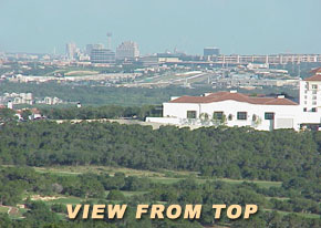 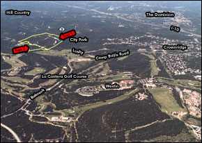 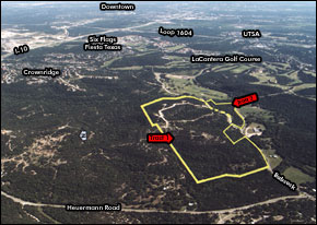 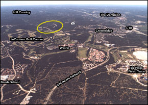 | ||||||||||||||
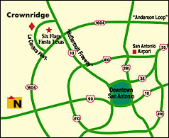
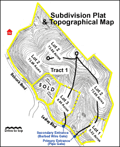
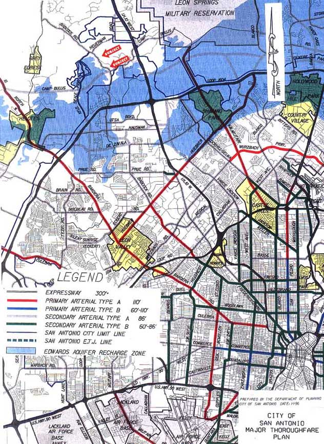
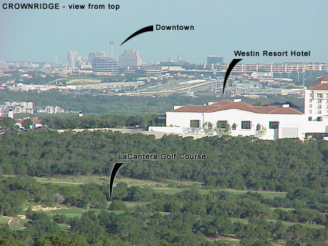
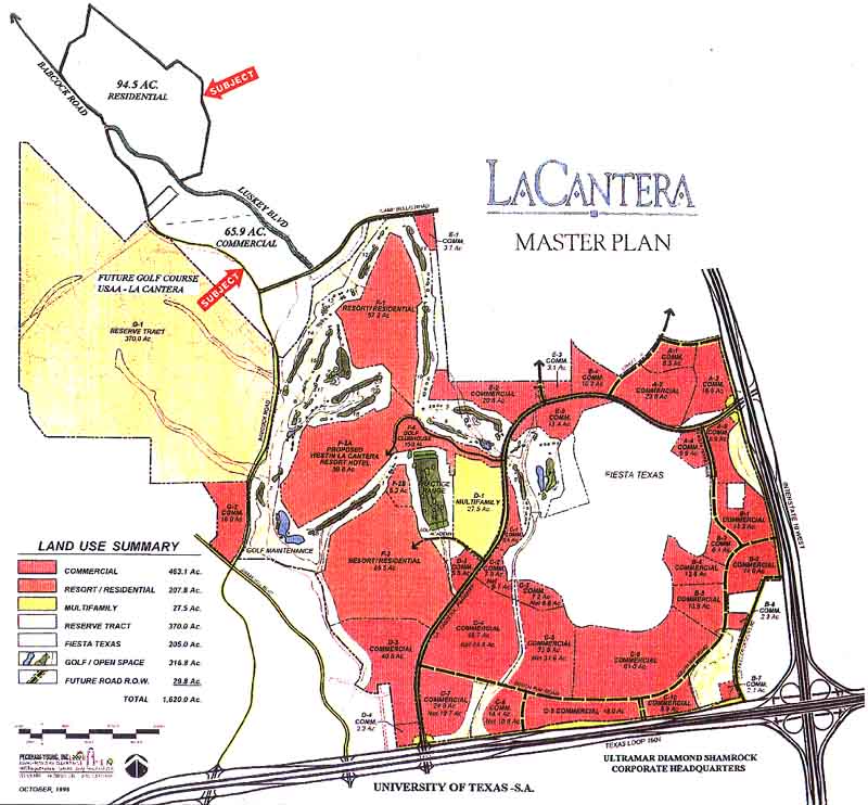
Site: [Click for tract photos] Tract 1 - 94.49 acres Lot 1 - 5.22 Acres Lot 2 - 73.86 Acres Lot 3 - 8.84 Acres Lot 4 - 6.62 Acres SOLD Tract 2 - 12.45 acres TOTAL Approximately 100 acres Property Type: Vacant Mixed-Use Land Property Address: Babcock Road and Camp Bullis Boulevard, City Limits of San Antonio, Bexar County, Texas. Description: Four parcels of land in the Crownridge Subdivision. Location: The Property is north of the San Antonio Central Business District. Travel I-10 to Camp Bullis Road. Exit west (left) on Camp Bullis Road to Babcock Road, then right (north) on Babcock to the location. The Property is on the east side of Babcock Road. Tracts are located south of Huerman and north of Camp Bullis. Tract 1 is on the northeast corner of Babcock Road and Luskey Boulevard. Tract 2 is on the southeast corner of Babcock Road and Luskey Boulevard. Access: All tracts can be accessed from Lusky Boulevard and Babcock Road. Zoning: R-1 Temporary. This zoning is used for newly annexed properties until permanent zoning is proposed by owner. Best Use: Residential Surrouding Property Use: The Property is in the Crownridge Subdivision, which is primarily residential, retail, and commercial/light industrial. Six Flags Fiesta Texas is approximately 2 miles southeast. The LaCantera golf course and residential resort community is approximately 1/4 mile south. Flood Plain: Portions of the Property are located within the 100-year flood plain. Topography: (click here for map) Easements: Customary drainage and utility easements. Refer to Title Commitment for further review. Deed Restrictions: The Property is restricted by the Crownridge Master Development Plan for a mixture of residential, commercial, and office development. Utilities: (click here for utilities map) Gas - City Public Service and Grey Forest utilities Sewer - City of San Antonio Water - City Water Board Electricity - City Public Service Telephone - Southwestern Bell Recharge Zone: None of the property is located in the Edwards Aquifer Recharge Zone. Traffic: Click here for traffic route map. (Large image - 154k) Tract Photos [Click for larger view] Building Road - 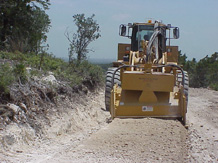 Crushing Rock for Road in Place 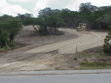 Spreading Rock 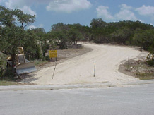 Finish Rock At Entrance 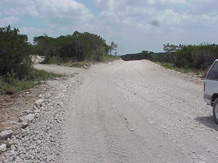 Finished Road Near Top |
 Click for a larger view 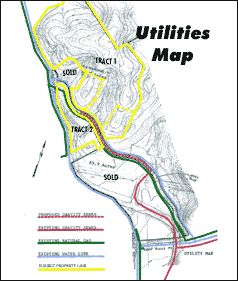 Click for a larger view Tract Photos [Click for larger view] 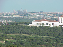 Downtown View From Top 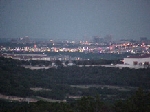 Downtown View From Top At Dusk 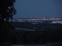 Downtown View From Top At Night  View of Fireworks From Top  Sunset From Top
|
|||||||||||||
An 8" sanitary sewer line is already in place within 1000' of each tract. Engineering drawings have been completed to construct the sanitary sewer to both tracts. Depending on how the property is developed, sanitary sewer may not be a requirement. Water lines and fire hydrants, as well as natural gas lines, are already in place the full length of Lusky Blvd, which provides these utilities to all tracts. The view of downtown San Antonio from the top of the Tract is tremendous. (Click for view) LaCantera just opened an Arnold Palmer designed 18 hole golf course on the west side of Babcock. (Click for LaCantera Master Development Plan) A golf academy is operating immediately south of the subject property. Other less glamourous but substantial development continues in the area. | ||||||||||||||